Advocacy

What does a parking cashout mean for Baltimore?

Written by Patrick Reid, UMBC student and Bikemore Intern

The Baltimore City Council passed an important new bill in March that could change how some city government employees commute. The new bill aims to study something known as a parking cashout.

Parking cashouts are an incredibly effective way to increase the use of alternative modes of commuting to work. Basically, parking cashouts give employees the cost of a dedicated parking spot as cash, allowing them to use the money to pay for alternative modes of transportation. Free parking at work is often an included employee benefit; this takes the value of parking to create incentive for using other modes of transportation. 

Enticing local business leaders to support sustainable initiative can sometimes seem like a daunting task, especially when many have their profit margins to consider. But a cashout program is a win-win situation. Employees receive a cash benefit,  and employers can save costs and even receive a tax credit. A study by the Maryland Department of Transportation (MDOT) illustrates how these savings work in an example below. 

A table showing how a parking cashout with the commuter tax credit would save employers money on employee benefit costs.

The table shows just how beneficial the parking cash out program would be for businesses who are looking to not only support sustainability and increase transit usage but also just cut down on their costs. By using the tax credit and maximizing the amount of money given to the employees who opt into the program the employer saves $7,500 while the employee makes an extra $50 a month or $600 over a year. 

The program is economically sound, but would it actually contribute to an increased use of alternative modes of commuting like bikes or transit?

According to a study in Washington D.C., it absolutely would. Looking at a sample of 987 Washington commuters who were faced with the prospect of not receiving free parking at their place of work, we see clearly some potential changes in behavior. For these commuters the options of biking or walking increased 15% while public transit usage increased by 31%. The number of commuters saying that they would get to work by “car alone” would fall by a staggering 50% to less than a quarter of surveyed commuters choosing to commute by car if the parking was not free!

parking choices dc.png

What these numbers look like in practice is a cleaner, more connected city that can shift focus away from cars and instead on new modes of transportation like bikes and public transit. It means a more environmentally sustainable future and many more options for commuting. The Washington-based survey data in addition to the economic report from MDOT show the feasibility of a parking cash out program for all stakeholders involved.

While the current proposal only looks at the city government, a broader rollout of a cash out program could really make a big difference in Baltimore. What the city needs are bold new ideas and the courage to pursue them. This program could have a really meaningful impact if it was rolled out to more industries throughout Baltimore. We have the chance to transform the way that Baltimoreans commute, to make it environmentally conscious, safer and even put a little extra money into each paycheck in the process. 

Dockless Vehicle 2020 Update

Screen Shot 2021-02-03 at 1.50.14 PM.png

Bikemore has supported the City’s Dockless Vehicle Program permit for e-scooters and bikes since before the pilot launched in 2018, writing the white paper that served as the basis for the pilot and supporting legislation to make the program permanent. 

While this year’s permit cycle was meant to end in August 2020, it has been on hold due to Maryland’s State of Emergency. So how has the scooter program been doing during pandemic times? 

Here are the highlights from the Department of Transportation’s latest update:

  • Vehicle trips in 2020 decreased 55.6% from 2019. We also saw a shift from weekday rush-hour commute trips to midday/weekend usage. 

  • Trips around the Inner Harbor, downtown, and at college/university campuses dropped significantly, while trips around parks and along transit corridors increased. 

  • DOT used Dockless Vehicle Permit funds to perform an audit on bike facilities and completed work orders to replace 100 flex posts, convert two storm drains to be bicycle/scooter friendly, and added green paint to improve visibility at intersections.

  • DOT is currently working on installing over twenty bike/scooter parking corrals around the city, prioritizing transit connections, reducing vandalism, and equity zones.

  • After the State of Emergency is lifted, DOT will release an updated Rules and Regulations for the Dockless Vehicle permit for public comment before vendor applications open.

  • Currently, SPIN and Lime are the only two dockless vehicle vendors in the city after Lime acquired JUMP and Bolt failed to meet permit requirements.

  • Lime has re-launched JUMP bikes in the city, but the fleet is still quite small.

Also, Lime chose Bikemore as their “Lime Hero” partner back in September 2020! Riders can round up their rides to make a small donation to Bikemore and have the opportunity to learn about our work through the app.

Read the full memo from DOT here.

Harford Road Bridge Redesigned with Complete Streets Principles

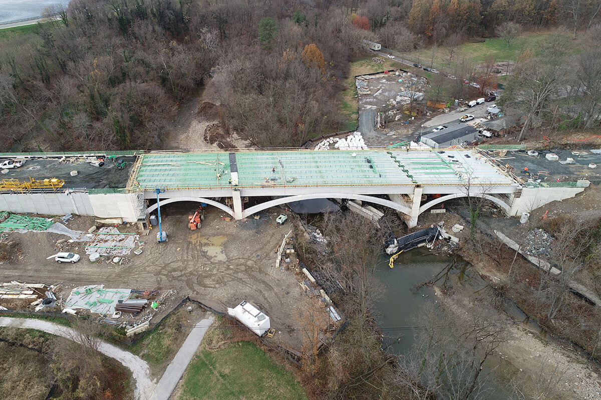
Last Thursday night, Baltimore City Department of Transportation hosted a meeting with eighty community members in attendance to provide an update on the proposed design changes to the Harford Road Bridge. 

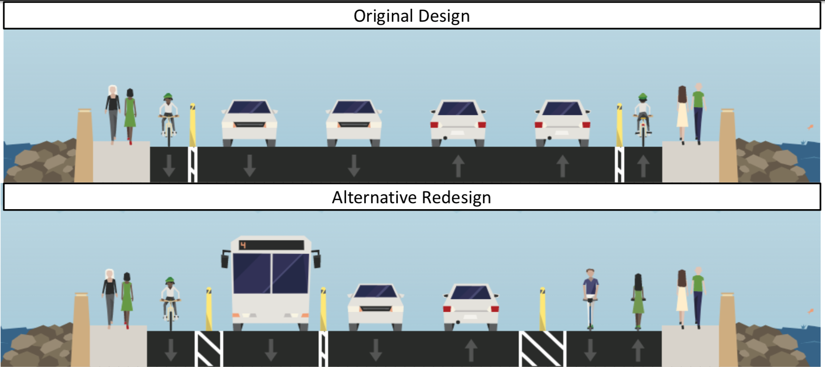
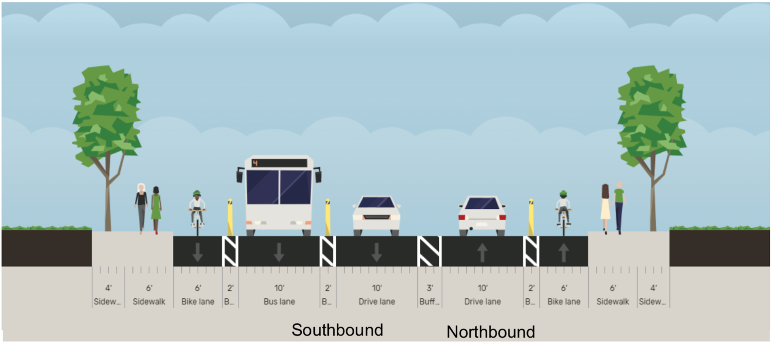
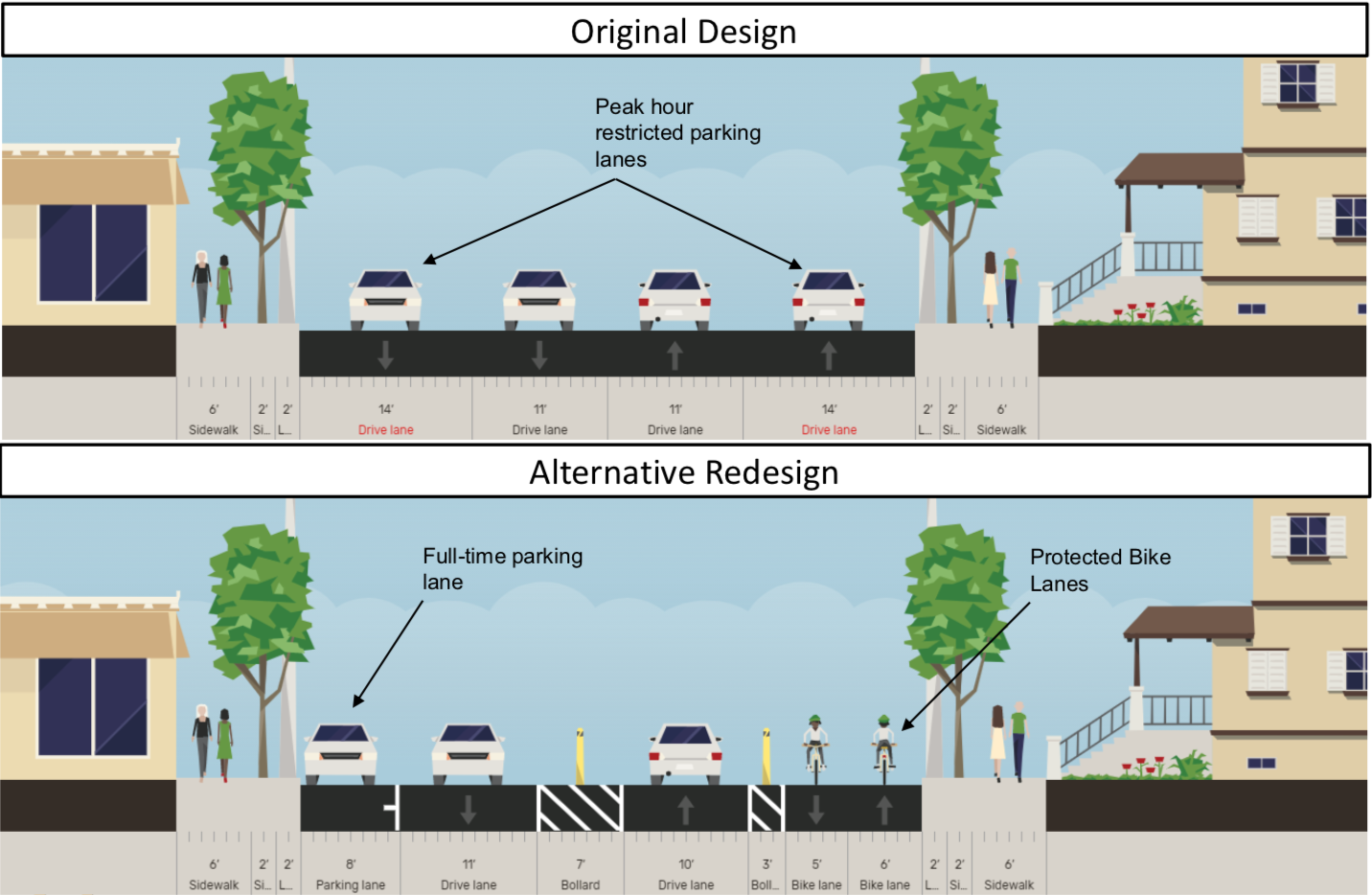
The newly proposed design reduces four lanes of car traffic to two, and reallocates this space to a southbound bus travel lane, additional lanes for mixed-use walking and biking, and more buffer between moving traffic and pedestrians. Complete Streets Manager Graham Young cited the newly adopted Complete Streets Manual and Separated Lane Network Plan as guiding documents for the new design.

The design also extends changes on Harford Road to the north and south of the bridge, reconfiguring dangerous intersections and extending separated bike lanes that make both people biking and walking on the adjacent sidewalks safer from passing cars.

Overall, folks on the call were excited about the new design and also advocated to keep Lake Montebello closed to cars and for additional closure of Walther Avenue between Harford Road and Argonne Drive.

We encourage you to view the presentation and leave comments on the proposed design here, or email dot-community@baltimorecity.gov with your comments. 

Since the Harford Road bridge has been closed, the streets to the north and south have seen less traffic and have been adjusted to accommodate space for other uses, like added parking, outdoor cafes, curb extensions, and separated bike lanes. These were long-standing community goals that existed well before the bridge project began design and construction. 

It never made sense to have a bridge design with 4 lanes of high speed car traffic and narrow, unprotected bike lanes. But that’s what the original design called for. 

From the first community meeting about the bridge, Bikemore called for a road diet and addition of separated bike lanes to the project. Neighbors complained about the high level of speeds along the current bridge, and were nervous to see the existing guardrails on the old bridge removed in the new design, because they provided basic protection to people walking across the bridge next to highway speed traffic. We were joined in calls for a re-design by then-candidate for 3rd District City Council -- Ryan Dorsey, who made changes to the bridge design a major focus of his campaign.

Despite Dorsey’s victory in the election, along with broad community support for design changes and Bikemore’s advocacy, no substantial changes were made from the original bridge design presented. In 2018, the bridge project moved to construction. As reported at the time in the Baltimore Sun:

City Councilman Ryan Dorsey, who represents the area and runs a Facebook page dedicated to news about the bridge, criticized the new bridge’s design as “incredibly unsafe” because the bike lane is not physically separated by barriers from the road, he said.

If it had been designed in Montgomery County, Dorsey said, a separated bike lane would be required due to traffic volumes and observed speeds.

“It’s really a failing of DOT that a safer design was not planned from the outset, even worse that safer design was called for by community members from the earliest stages, but DOT insisted on this unsafe design,” Dorsey said. “This DOT has not really inspired much confidence so far, but I’m still holding out hope that a change will be made before we get to a point where it’s really too late.”

Over the past 15 years, the city transportation department has ignored calls from residents, advocates and public officials to build a new bridge that is safe and accessible for pedestrians and bicyclists, said Jed Weeks, policy director of Bikemore, a bicycle advocacy group.

“Instead, they've doomed generations of Baltimoreans to an unsafe design with minimum width sidewalks and unprotected bike lanes next to speeding traffic,” Weeks said in a statement. “This bridge is a total failure in planning and an example of why we had to pass an ordinance to force BCDOT to do better in the future."

While the beginning of construction marked the end of advocacy for a smaller bridge design that could have saved millions of dollars in construction costs, we continued to advocate for an improved reconfiguration of the wide bridge that was to be built. In that time, we gained new leadership in the mayor’s office, new leadership at BCDOT, and Councilman Dorsey was re-elected, cementing that there is broad support for his complete streets vision within the 3rd District.

This redesign, combined with the closure of Lake Montebello to car traffic, the coming design and installation of trail along St. Lo Drive and 33rd Street, and future expanded separated bike lanes along Harford Road are a culmination of years of advocacy that would not have been possible without Bikemore’s supporters.

#FillTheRoom at Upcoming BCDOT Meetings

This Thursday, Baltimore City Department of Transportation (BCDOT) is hosting two meetings that will affect bicycle infrastructure connectivity. Bikemore staff will be joining to hear updates and provide input on equitable design. We hope you can come too, especially if you’re a resident of the areas where the infrastructure will be built.

Harford Road Bridge Meeting 

Thursday, January 21 | 6pm | On WebEx

Construction on the Harford Road Bridge over Herring Run began in 2018. The original design for the bridge included standard bike lanes next to four lanes of high-speed traffic, despite widespread community requests for the new design to slow down cars and provide safer space for biking and walking. 

We have been advocating alongside District 3 Councilman Ryan Dorsey for a Complete Streets redesign of the bridge that includes space in which people of all ages feel comfortable walking and biking. BCDOT will provide updates on the design changes under consideration during this meeting.

Details + Meeting Link

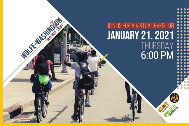
Wolfe/Washington Cycle Track Meeting

Thursday, January 21 | 6pm | On WebEx

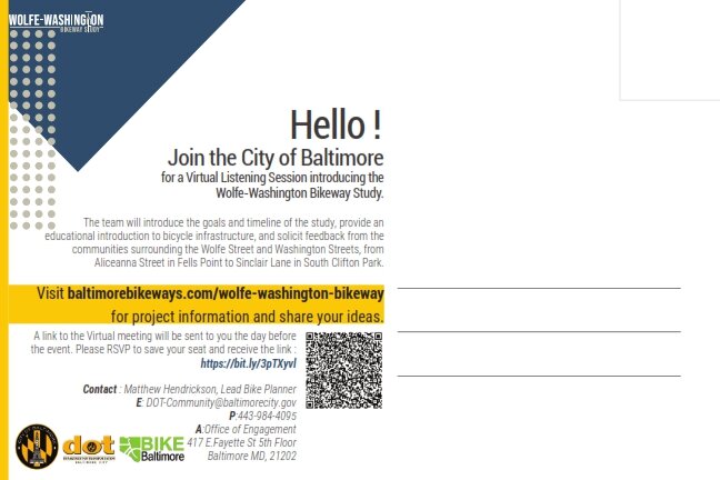
As part of the Separated Lane Network Plan released in 2016, a North/South connecting separated bike lane is planned to be built on either Wolfe St. or Washington St. This meeting will kickoff discussion on a design and selection of which street would serve as the best connection.

A separated bike lane on Wolfe/Washington St. would be a critical route through East Baltimore for people of all ages and abilities to feel comfortable using. It would connect the Promenade and Monument Street for East/West travel and to a planned trail connection on St. Lo Drive that would provide access through Clifton Park to future separated lanes on Harford Road and the future Baltimore Greenway Trail Network on 33rd Street and Herring Run.

Details + RSVP (Required)


If you are able to join and show your support for biking and walking infrastructure on these corridors, please sign on to fill the virtual room. 

Have questions? Feel free to email us at info@bikemore.net

What Slow Streets Can Teach Us

Slow street on 27th St. in Remington. The wooden barrier with Slow Street signage is to the left. A small child riding a tricycle, wearing a bright green shirt and blue helmet is to the right.

This summer, in response to legislation introduced by Council President Scott and unanimously supported by Baltimore City Council, the Baltimore City Department of Transportation started its Slow Streets program. Yellow barriers began popping up around town discouraging through traffic and encouraging slower speeds on neighborhood streets. This concept is being implemented in cities across the country due to an ever increasing demand for public space. People are home more. Our usual gathering spaces have been limited. So what better way to increase places to be than activating the largest amount of public space the City of Baltimore owns--our streets?

The program has had its challenges, challenges that have been seen in implementations across the country. these interventions need to be paired with widespread public communication so people understand their purpose, and programmed in ways that invite people to see the streets as a new front yard.. Local neighborhood champions have also been critical to success, and it has been encouraging to see neighbors step up in their communities to steward the program. 

For Bikemore, Slow Streets has helped us explain the benefits of calming traffic on neighborhood streets. Too often Complete Streets advocacy is full of jargon that is hard to relate to. No rendering or sketch can do as good a job explaining the benefits of traffic calming than when folks can stand outside of their house and experience it themselves. For that reason alone, the Department of Transportation should be commended for investing in this program. 

This became evident last Saturday while spending time in Curtis Bay. South Baltimore is so often overlooked when it comes to investment. But the City Council and the Department of Transportation have been intentional to ensure each council district receives a Slow Street. 

We were spending time with neighbors at the Filbert Street Garden, getting feedback on the Slow Street recently installed on Filbert Street and discussing future programming to activate the space. In between falling in love with Ed the Goat and Marshmallow the Chicken, and marveling at all the late summer crops that neighbors have nurtured, I walked across the street to meet a neighbor mowing her lawn. 

Over the years she’s put a lot of effort into her home. Her lawn, flowers and trees are beautiful. She proudly displays a sign noting that she won second place this year in the Curtis Bay yard competition. As we stood there chatting, multiple cars drove through the intersection where the Slow Streets barriers had been placed. We noted how even while speeding to the intersection, each car had to stop and look carefully before going through the stop sign. We both sighed at how it both worked to slow down cars there, but did little to prevent speeding just a few car lengths up the road. We brainstormed different ideas about how it could be better. What struck me was that after asking a simple question, “What do you think of these barriers?” Her insight spoke directly to the purpose of the program. She noted how kids are out playing in the street more now that we are all at home. And that the barriers make it safer for them to be outside. And she said she wanted to see more traffic calming in her neighborhood. 

Before the barriers I know that conversation would have gone differently. I would ask about traffic on someone’s street. They would agree that traffic could go slower. But it was hard for them to imagine interventions beyond speed humps--something that is costly and not always appropriate for the street. And too often that is where the conversation would end. Any other solution would inevitably be seen as intrusive and not something that the community requested. Not because they don’t want traffic to go slower, but because the community input process is designed to fail. 

Citizens shouldn’t be responsible for dreaming up solutions to problems the City already knows how to fix. The City shouldn’t create impossible thresholds of community support before we try something new to make a street safer for people who walk, bike, and take transit. What the City can do is double down on what Slow Streets has demonstrated works really well. Install temporary ways to calm traffic. These experiences should be the beginning of the community input process, not the end result. Prioritize providing neighbors with experiences to make informed decisions. 

Neighbors are the experts of what they need in their community. And for too many streets in this City, the need is for people driving cars to slow down. Allowing neighbors the ability to experience a variety of solutions first-hand means that whatever the solution is, people understand what to expect. Fear of change and the unknown is often the biggest barrier to make our streets better. 

It’s unrealistic to believe that every Slow Street in the city will lead to lasting change. But my hope is that it has provided a better starting point for that change to occur. It demonstrates the best of what DOT has to offer--equitable distribution of resources, low cost solutions that are easily replicated, and changes to the street that help people reimagine what is possible. It begins to answer the question, “How do we build streets for people?”

by Liz Cornish, Executive Director